Climate Adaptation
ResilientWoodsHole is moving on to take action and implement resilient solutions. Potential solutions were developed by RWH for each neighborhood in Woods Hole. Four main themes of solutions were identified by the community, including maintain character, protect and connection, nature-based solutions, and living with water.
Click or hover over each theme below to learn more.
Adaptation Themes
Maintain Character
![]()
Solutions to preserve the existing uses and maintain historic character of Woods Hole.
Examples include using flood barriers that can be deployed before a storm, and flood proofing buildings and utilities.
Nature-Based Solutions
![]()
Solutions that use natural features and processes to help promote climate resilience.
Examples include beach and dune restoration, restoring, marshes, and creating living shorelines using plants and oyster beds.
Protect/Connect
![]()
Solutions that provide physical protection and connection of infrastructure.
Examples include seawalls and raising roads and buildings, and moving building systems like utilities to higher floors.
Living with Water
![]()
Solutions that reimagine Woods Hole Village through the lens of living with water.
Examples of these solutions include relocating buildings to higher elevations, or buying land from property owners that floods regularly.
Dynamic Adaptation Pathways
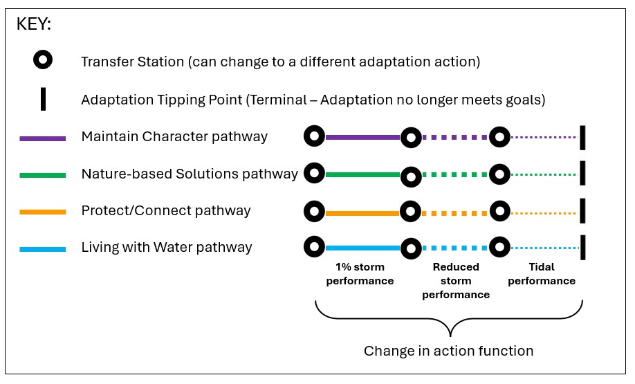
Every set of solutions for each of the neighborhoods in Woods Hole has a dynamic adaptation pathway chart that provides a concise visualization of the potential actions, their effectiveness, and on what time horizons.
Click on each red pin to learn more about how to use this powerful tool.

As you move left to right along a path for a particular solution, you will encounter a 'transfer station' at each time point. These 'transfer station' represent a decision time point and opportunity to 'transfer' to another solution.
Marker 2The black vertical bar represents stopping points, or solutions that cannot provide flooding protection for the water levels predicted at that time point.
MarkerSolid lines indicate that a solution, in this case a solution that helps maintain character of the village (purple line), is effective for really strong storms (1% storm events).
Marker 4When a solution is no longer effective to protect against a really strong storm (1% storm), its effectiveness can change to a thick dashed line, which indicates that solution is effective for weaker storms.
Marker 5When a solution is no longer effective to protect against a weak storm, its effectiveness can change to a thin dashed line, which indicates that solution is effective to protect only against tidal inundation, but not weak and strong storms.
Marker 6When a solution reaches the stopping point along a specific solution pathway, it represents that the solution does not provide flood protection for the water levels predicted at that time point.
View the Adaptation Solutions
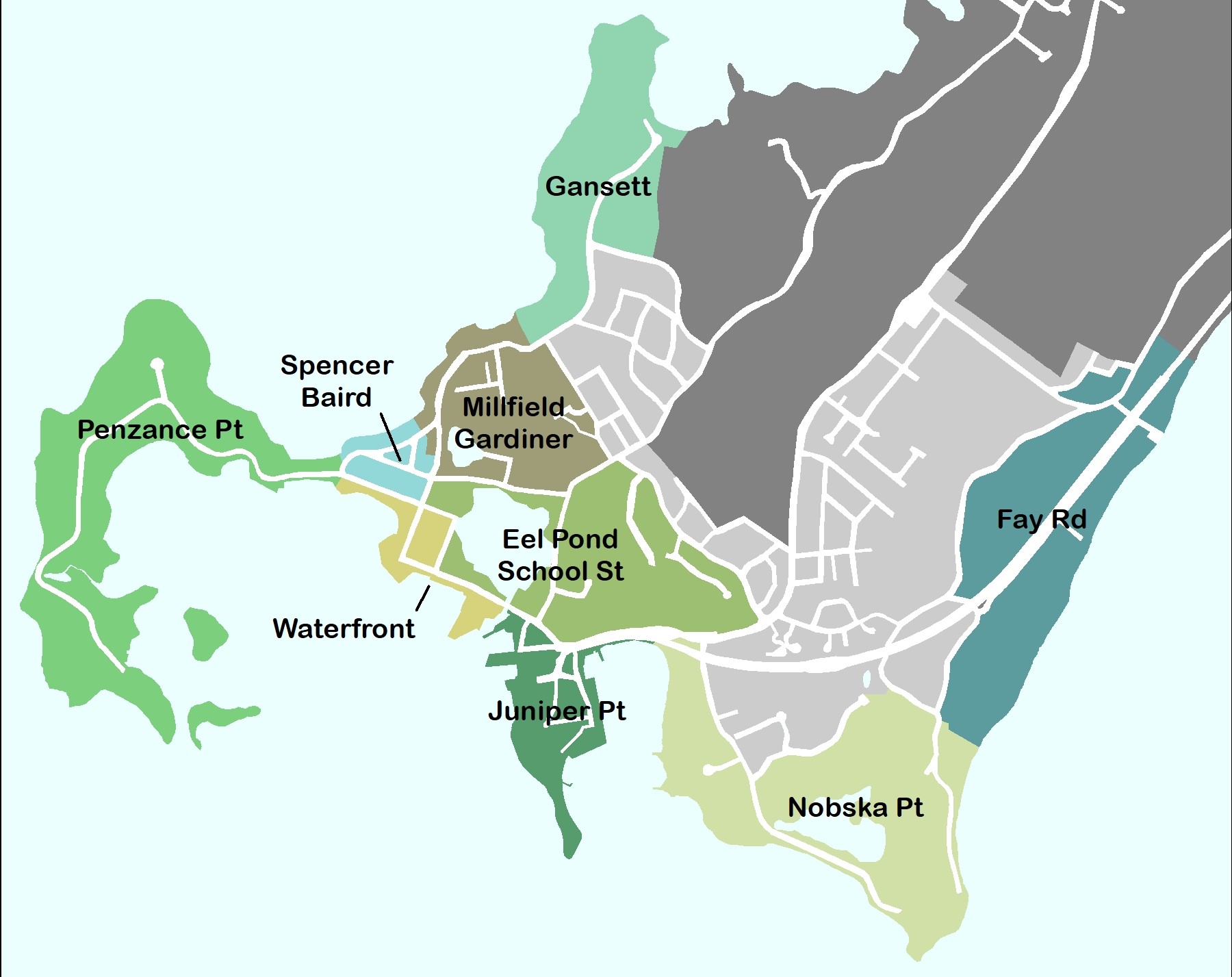
Click on each dot to view the adaptation solutions for that neighborhood.

