ResilientWoodsHole looked at how different parts of Woods Hole could be affected by flooding with sea level rise and coastal storm flooding. We evaluated the vulnerability of:
- Structures, including residential, businesses, institutional buildings
- Lifelines, including Town assets (ie. sewer), US Coast Guard buildings, and Steamship Authority infrastructure
- Roadways
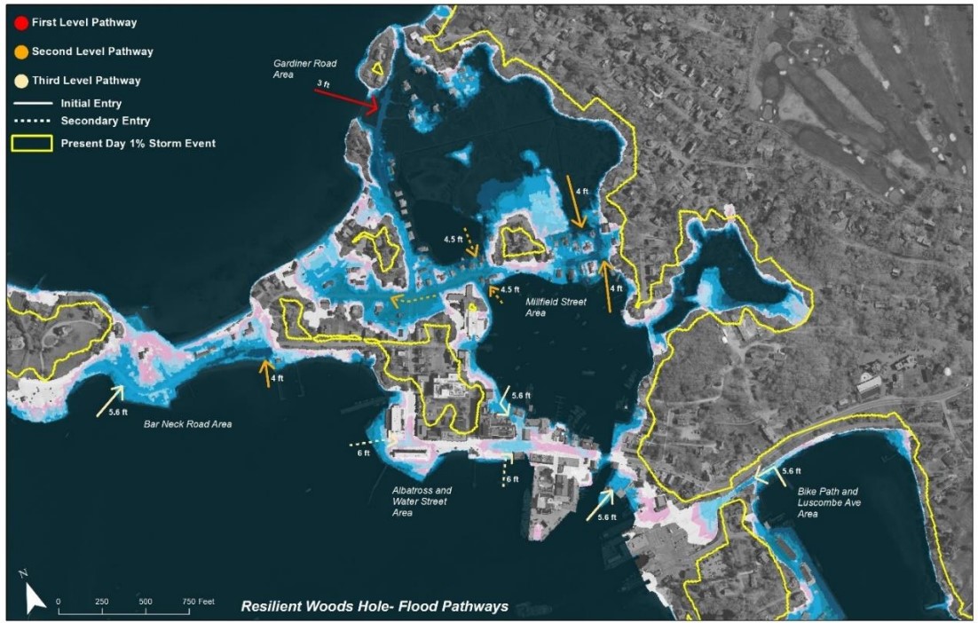
We discovered that many areas of Woods Hole are low-lying and are already being impacted by flooding. Our assessments found that by 2070, more than 30% of buildings and over 25% of roads will be flooded during strong storms. Using this information, we developed flood pathway maps to show how flood waters will move in Woods Hole during storms. Identifying flood pathways helps us understand where flooding might occur and plan better to protect those areas.
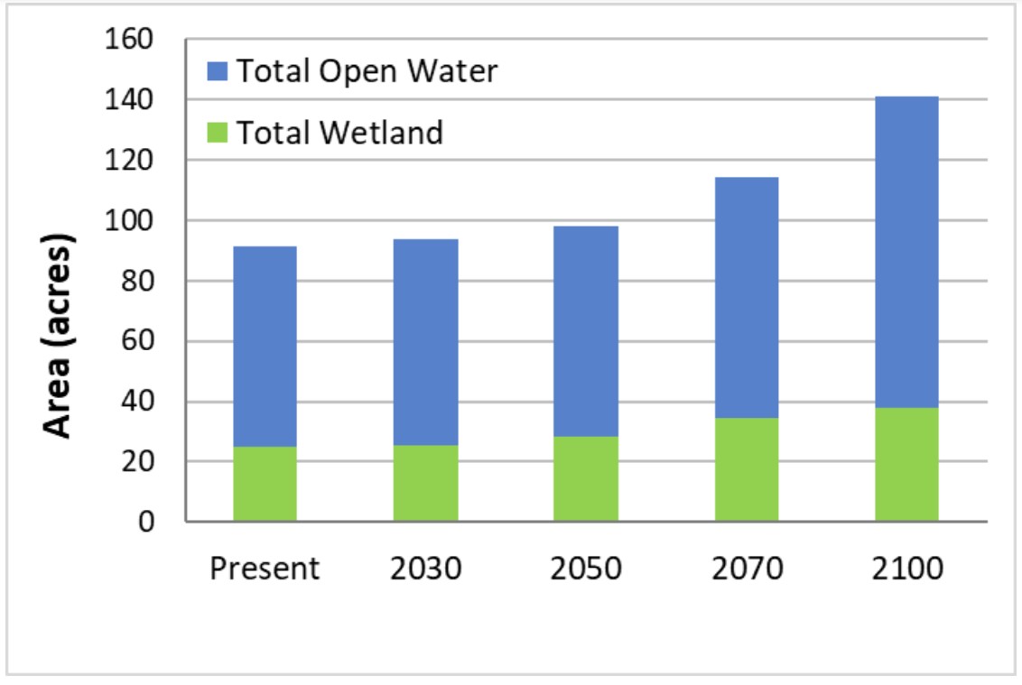
We also evaluated how natural features might change. We found that, in the near future, sea level rise could turn freshwater wetlands into salt marshes. Over the long term, this could lead to a mix of beaches, tidal flats, and open water, reducing the overall salt marsh area.
These findings highlight why it's so important to plan ahead and take action to protect our community and the environment!


Vulnerability Assessment of Buildings Present Day to 2070
Vulnerability Assessment of Roads Present Day to 2070
Definition: Vulnerability assessment
Vulnerability assessments help us understand how likely something—whether it's a natural environment or a human-made system—is to get damaged or benefit from climate change. We look at three main things to figure this out: how exposed it is to climate changes, how sensitive it is to those changes, and how well it can adapt or adjust to them.
Definition: Flood Pathway
A flood pathway refers to the routes or areas where floodwaters are likely to travel and spread during a storm or heavy rainfall. This includes the paths water takes as it flows over land, moves through streets, or enters buildings.
