RWH is moving towards a resilient future in Woods Hole.
Current Projects
Demonstration Projects
RWH completed commercial demonstration projects at NOAA's Aquarium, WHOI's Bigelow Building, and MBL's Lillie Laboratory. For WHOI and MBL, RWH worked with floodproofing professionals to identify vulnerable rooms in each building, prepare and choose flood proofing barriers, and install those adaptation solutions. Check out the RWH Phase 4 Report to view the solutions and learn more about the process.
Stoney Beach
RWH completed the Stoney Beach Feasibility Study in November 2023. In this study, RWH evaluated current conditions of the beach, performed dune crest performance modeling, and reconfigured the additional amenities on the beach. RWH hopes to continue with design, permitting, and reconstruction of the dune crest and beach nourishment at Stoney Beach to reduce its vulnerability to storm induced flooding.
Outreach and Engagement
RWH has developed a robust outreach and engagement program. Over the last few years, RWH launched community-focused Neighborhood Working Groups, developed a climate resilience walking trail around Woods Hole, collaborated with a local museum for a climate resilience exhibit, participated in many events and many more. Learn more about our outreach and engagement here.
View our Work
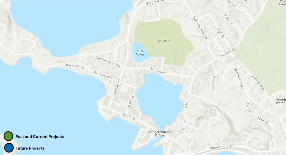
Click on the green circle to view our past and current projects and on the blue circles to view our future projects.

Stoney Beach
RWH completed the Stoney Beach Feasibility Study in November 2023. In this study, RWH evaluated current conditions of the beach, performed dune crest performance modeling, and reconfigured the additional amenities on the beach. RWH identified that a 10ft NAVD88 dune crest elevation with beach nourishment below the water line would provide protection to the beach from a strong storm. RWH hopes to continue with design, permitting, and reconstruction of the dune crest and beach nourishment at Stoney Beach to reduce its vulnerability to storm induced flooding.
Mill Pond/Eel PondMill Pond/Eel Pond
One of Woods Hole's main flood pathways runs through Mill Pond and Eel Pond. During strong storms, water goes over a seawall just north of Mill Pond and funnels into the pond, Woods Hole Park and the surrounding residential neighborhood due its low elevation. Two culverts that connect Mill Pond and Eel Pond easily overflow during strong storms, causing flooding of Millfield Street and homes. RWH is exploring possibilities of nature-based solutions to reduce the flooding between Mill and Eel Pond during storms.
Water StWater Street
The Woods Hole Waterfront, the only deep water access port on the Cape, connects all stakeholders, including businesses, community members, organizations, and important lifelines. The built up waterfront has been historically flooded by hurricanes and strong storms. RWH is exploring some solutions to protect the waterfront, including installing deployable flood barriers on community buildings.
Stoney BeachRWH completed a Stoney Beach Feasibility study in November 2023, in which we evaluated the feasibility of dune restoration at the beach. This study found that a 10ft NAVD88 dune crest elevation and beach nourishment will provide protection from a strong storm. To learn more, check out the Stoney Beach Feasibility Report.
Marker 5Funded by a CZM grant, NOAA completed a flood proofing project of a vent shaft in the Aquarium basement. Learn more in our Phase 4 Report.
Marker 6WHOI's Bigelow Building
Funded by a CZM grant, RWH worked with WHOI to floodproof vulnerable doors and windows using deployable barriers at WHOI's Bigelow Building. Read the Phase 4 Report to learn more.
